Strategic Flood Risk Assessment Appendix F
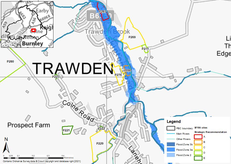
Trawden - flood risk from rivers
Maps showing the risk of flooding from rivers, and the risk of flooding from surface water
- File type: JPG
- Size: 109.42 KB
Our teams are clearing fallen leaves across the borough as part of our regular cleansing programme. Thank you for your patience while this work is carried out.
Maps showing the risk of flooding from rivers, and the risk of flooding from surface water